Advanced Geoscience Software Suite
Our comprehensive software solutions combine cutting-edge AI, machine learning, and geoscience expertise to revolutionize how you explore, analyze, and understand Earth's processes. From geological mapping to deep-time analysis, our tools are designed for both research and industry applications.
Kalpa
A comprehensive geospatial AI platform that unifies satellite data, geological information, and advanced analytics in one integrated environment.
Key Features:
- AI-assisted geological mapping and mineral prospectivity analysis
- Satellite data processing with automated change detection
- 3D subsurface modeling and visualization
- Machine learning toolkit with explainable AI capabilities
Vyom
Python-based plugin designed for highly efficient, flexible, and scalable access to satellite Earth observation data.
Key Features:
- Resolution-aware querying at user-defined resolutions
- Pre-download processing with lazy loading architecture
- Fast spatiotemporal querying for large datasets
- Multi-sensor support: Landsat, Sentinel, MODIS, ERA5
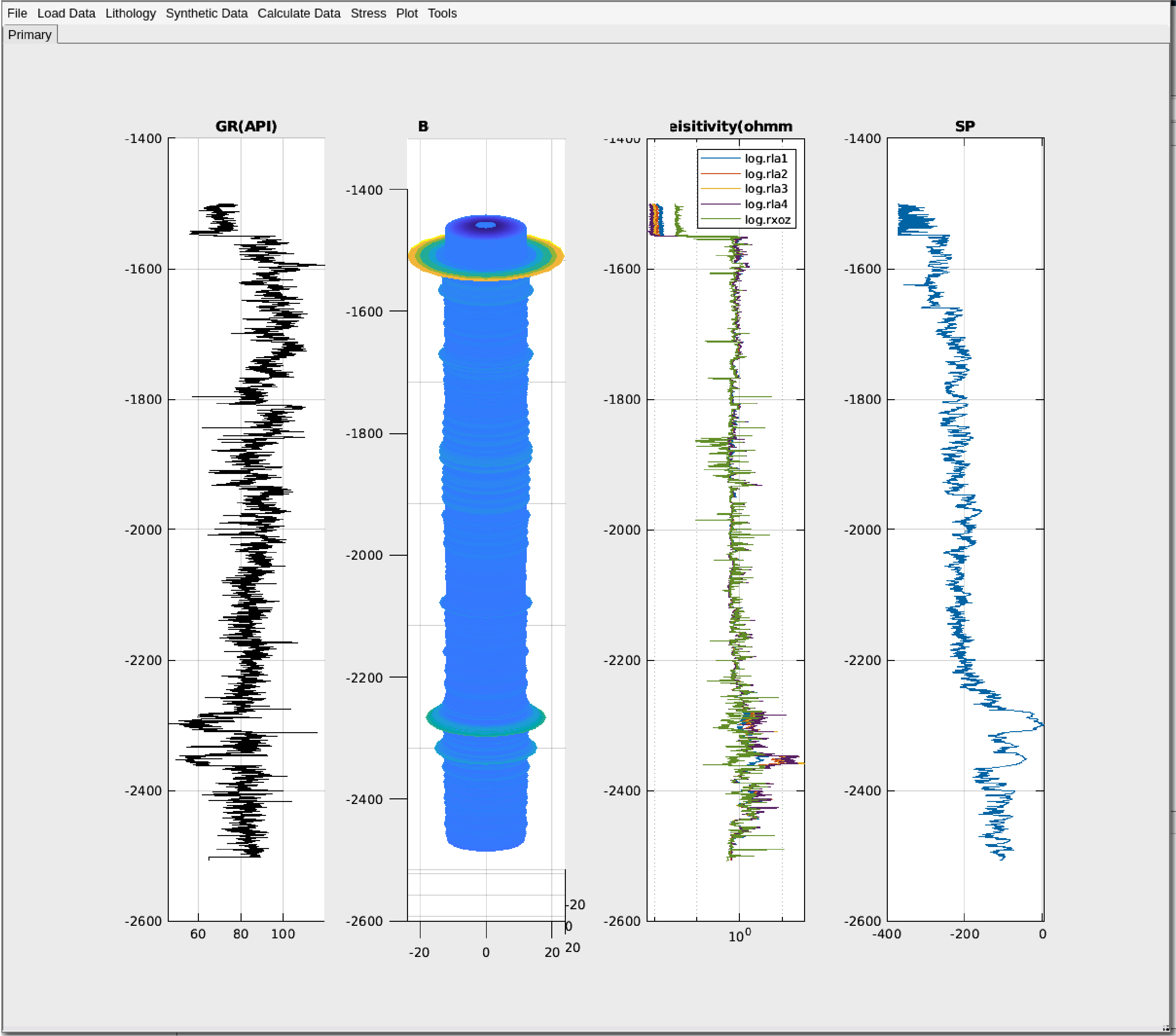
GeoMech
Open-source geomechanical modeling software optimized for borehole stability analysis and drilling risk assessment.
Key Features:
- Predictive modeling for pore pressure and stresses
- Powerful GUI for interactive well log analysis
- Synthetic log modeling and curve fitting
- MATLAB integration for advanced workflows
pyDTDM
Powerful open-source Python library for deep-time spatiotemporal geological data analysis and paleogeographic reconstruction.
Key Features:
- Plate tectonic modeling and Earth surface reconstruction
- Machine learning integration for geological prediction
- Explainable AI models for transparent understanding
- Multi-dimensional dataset analysis capabilities